Saturday, August 6, 2011

Sunny Skies At Last!

 By the time we had arrived back in Grand Marais after our all-day outing, the fog had lifted, the rain was gone and the skies were clearing! I'm glad I was able to appreciate the true beauty of this area! I would have had no clue as to how scenic and serene this quaint little harbor really was!
 Here's the west end of the harbor, looking out into Lake Superior with the Grand Marais Harbor Range Light in the background.
And the sunset didn't disappoint either!


I forgot to mention, that the beach is a nesting ground for the endangered Great Lakes Piping Plover! There were two nest sites on the beach. Even though we stayed behind the roped off area (about 10 feet from the nesting site that was caged), mama plover was squawking at one of here brave chicks that escaped the nest and ran outside of the cage (he was soooo tiny! about 1/2 the size of a small mouse!). It was rather hard to spot the chick as he blended in rather well with the beach rocks and sand. We could really only spot him when he was running! Anyway, the chick finally returned to the nest and snuggled under his mama, and mama stopped her alarm calls.

Tuesday, July 26, 2011

Upper Taquamenon Falls

After leaving Whitefish Point, we headed south, then west to get back to Grand Marais. Since it was only 6:30, we decided to make a very quick stop at Taquamenon Falls. Choosing the upper falls, we hiked quickly to the falls, it was once again raining, took a few photos, looked around, then headed back to the car. This is the last waterfall video you'll see of this trip....I promise!


 For those of you that get seasick during my unsteady videos, press play, listen to the sound, but just look at this photo!

I wish we would have had a bit more time here, but I'd prefer not to drive in the dark in "big animal" country! I'll be back in the UP in less than 2 months, hopefully, I'll have the better part of the day to spend here, hiking between the upper and lower falls!

Monday, July 25, 2011

Lighthouse Climb...Whitefish Point

Late afternoon we arrived at Whitefish Point. It was still quite foggy and overcast and we were greeted by a foghorn (not the original) which is (hopefully) the video that I have placed in this spot! 

Due to the increase in shipping activity (especially mining), and the large number of shipwrecks near this location, Congress approved a Lighthouse (and later a Lifesaving Station) on Lake Superior at Whitefish Point which was completed in 1849. Weather was not kind to it, and it was rebuilt in 1861. Not the typical construction as to what we are used to, but actually an iron cylinder, much more stable in the high winds and weather at this location. 


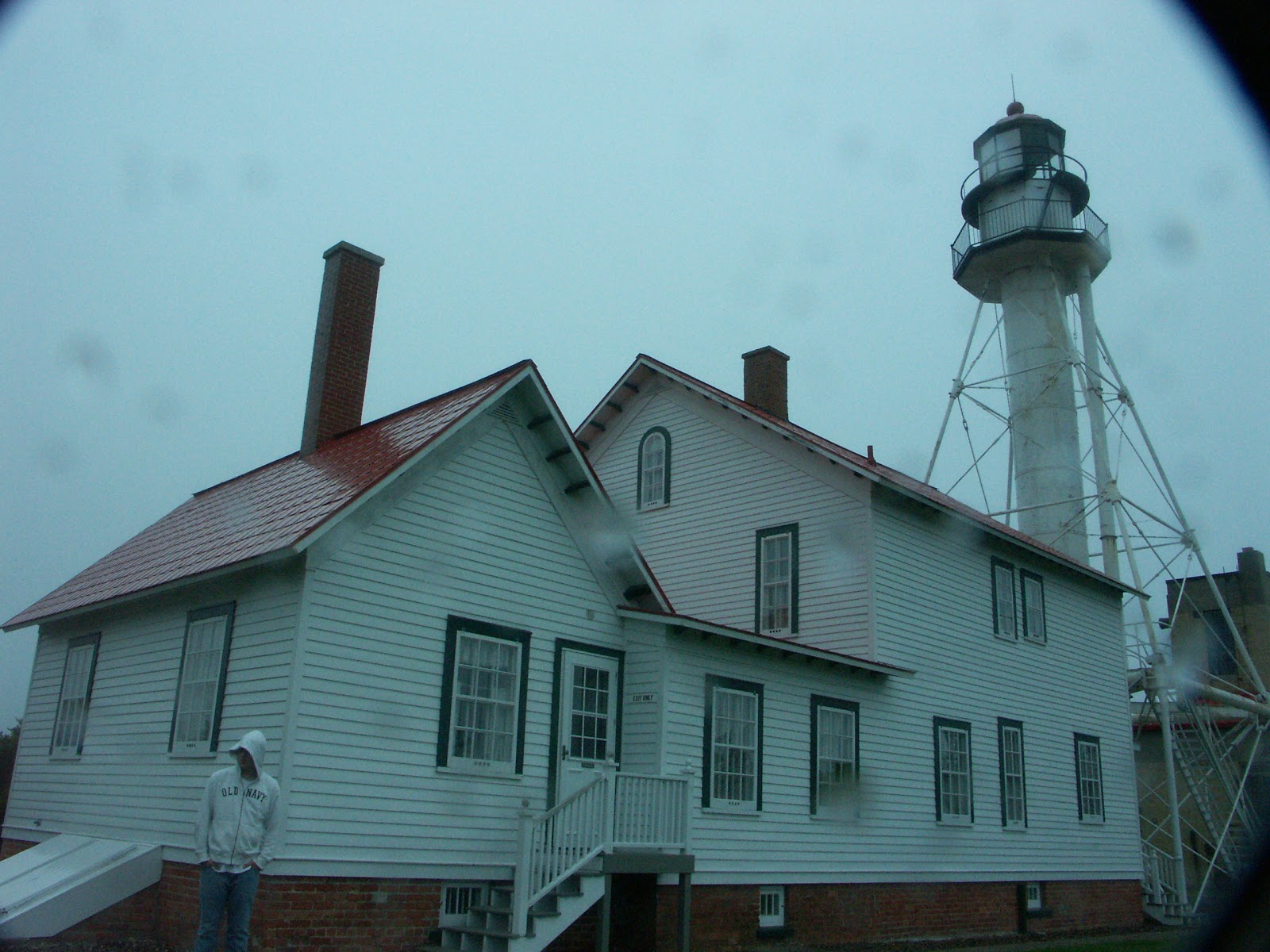
 On this very rainy afternoon, you can see the light and the keepers quarters. An assistant keeper was deemed necessary in 1895, and the quarters were remodeled into a duplex.
 Just as were were getting ready to leave, the sun started to come out and you can see the grounds from....the gift shop! Where they had dozens of books I really wanted to take with me, but I narrowed it down to....4!

The large rudder and tiller in the foreground is from the M.M.Drake. The 201 foot vessel sank 6 miles west of Whitefish Point on October 2,1901 in a collision while trying to tow the 212 foot schooner Michigan.


Of course, if the tower is open you know I HAVE to climb it! It was only 57 steps to the top of the cast iron tower, but it was VERY narrow, nearly claustrophobic, the steps were the narrowest I had seen, even with my tiny feet! And (being an iron tube) no windows. That was a first for me. So this is the view to the south, the red roof below is the keepers quarters, behind that a building with a VERY touching (and teary) film about the Edmund Fitzgerald and the raising of its bell a few years ago. To the rear left of that is the Great Lakes Shipwreck Museum (highly recommended) and to the right....the impressive gift shop!

 Here's Alyssa waving at me from below, no one else wanted to climb to the top. Rule #1 should be "Never pass  an opportunity!", the tower had been closed to the public for many years, but has just been recently reopened to climbing as it is celebrating its 150th anniversary this year! Of the rebuilt one that is.
 Another view from the top. To the left is the gift store and to the right was the barracks for the men that manned the Lifeboat Rescue Station here from (I think) 1923 to 1970. This building now serves as a Bed & Breakfast. I think some time I may just come back & stay for an evening! The closer building (that I have cut off) was the building in which the rescuers stored their lifeboat and other lifesaving equipment.

Looking west on the shoreline of
Lake Superior.

Directly north was a nice boardwalk (didn't  have a chance to explore that),beach and at the bottom of the photo, the foghorn building, reconstructed in 1935. Although you can hear the foghorn sound in the video, the actual foghorn was removed by the Coast Guard in 1995, as they considered it obsolete, with the advances in shipboard navigation and all. 

 And, finally the view to the east, the "point" of Whitefish Point and Whitefish Bay. Upon leaving, there was a smaller building on the opposite site of the parking lot. Seems like the wooded area is a refuge for migrating birds, especially spring!
 I'm not sure if you can see my foot, but it shows just how narrow the steps are! My leg is against the back of the previous step and my toes are hanging over! Keep in mind a size 7 is too big for my teeny feet!
The Lifesaving Station had some really
great exhibits! I wish I would have had more time here! This was the preferred method to rescue crew off of vessels, as it was quick and less risky! It's a breeches buoy. The Keeper would load a Lyle gun that sent some sort of projectile to the ship in peril. The projectile was attached to a line. The crew then secured the line as instructed, and the the Keeper would send the breeches (looked like a big pair of britches if you ask me) over. The line would act like a pulley system, bringing crew to safety, one at a time.

 The last resort was to haul out the Beebe-McClellan self-bailing, water-ballast surfboat. A crew of 6 to 8 oarsman and the keeper would run this 25x7 boat to the water (and it wouldn't necessarily be the water right it front of the light either, sometimes it was necessary to port it a few miles!), and start rowing to the folks who needed to be rescued. They could bring aboard up to 15 survivors. One of the books that I almost bought detailed the Lifesaving Division and explained more in-depth of their routines and had several stories of rescue.....I'll be sure to pick that up next time!

And I certainly couldn't leave out
a picture of the bell of the
Edmund Fitzgerald. Raised only a
few years ago, it is now housed in
the museum.
By the time we left, the skies had started to clear, and the fog horn had ceased .

Saturday, July 23, 2011

Munising Falls

To end our day, we hiked a very short,  maybe 1/3 mile walkway into a gorge to see Munising Falls. I think this was my favorite waterfall of the trip. The canopy of trees was so thick you didn't notice the fog nor the ever present raindrops! I'm sure on a hot day  this would be a great place to be also! 


 Another walkway led us to the other side of the waterfall, and from here you could see the area where, until a few years ago, you could walk behind the falls on the sandstone! Unfortunately, due to crumbling rock, this is off limits for safety purposes, bummer! How serene that would be!


And now for some videos of Munising Falls and the stream it flows into!


Miners Castle

 After our hike to Au Sable Light Station, we continued east on H58 toward Munising and decided to check out Miners Castle. One of the more recognized and viewed vistas at Pictured Rocks National Lakeshore, this was our view. Miners Castle should have been on the lower left corner of the downward sloping trees. But, the fog pretty much obscured the view from here....wasn't there a Stephen King movie about fog???It was actually sort of creepy here, with the current weather conditions and all.

We followed a short trail, only
maybe 1/3 to 1/2 mile at the most
to another viewpoint that was closer
to the formations.  I was guessing that it was supposed to be more scenic than this. So, we left, deciding to check this area out again tomorrow, and hopefully the weather would be more cooperative.

And it was! Friday wasn't a perfect day, but, the weather was improving, the dense fog had mostly dissipated, a few showers remained here and there.  

 I think sometime I shall come back here and perhaps take a kayaking tour!

Looking east, toward Munising, I believe that is Grand Island in the background. As you can see, the weather was still far from perfect. We had originally planned to do a boat tour, but with the skies being so overcast and waves at a 6 ' chop, we decided against it. Maybe next time.

Au Sable Light Station

 Our very rainy 1.5 mile trek to the Au Sable Light Station began where Hurricane River empties into Lake Superior. These nice ladies pointed us in the right direction to find the trail and suggested a beach walk for a while.
 Since the sand was quite wet, it did make for easy walking. But by this time it was nearly 11 am and was still quite foggy! I would expect that on a clear day it would have been quite scenic!
 So, we opted to head back to the trail in the forest to see what we could find there. There was green everywhere but every once in a while I would find a tiny spot of color like this delicate Twinflower of the Honeysuckle family!
I spotted quite a bit of Canadian Dogwood all through the very shady trail, which actually helped to shade us from a great deal of the raindrops!

Occasionally, there would be a break in the
treeline and you could peer out onto Lake Superior, I paused to check the conditions,  yep, still foggy!

Found a large patch of one of my favorites, Prickly Rose!

 About every 1/4 mile we came across a natural drain where water from above was flowing, rather quickly, downhill. No one had thought to bring boots, including me, so navigating across these little rivers proved to be a little tricky in order to keep everyone's feet dry!
Our first glimpse of the Au Sable Light!

 Completed August 19, 1984, the 87 foot tall lighthouse was considered to be one of the most remote light stations in mainland America. I know what your thinking, if it took me 1.5 miles to walk it, why is it considered remote?? Well, a century ago there were no roads in this part of Michigan. The closest town was Grand Marais, 12 miles to the east. Provisions and transportation was only by means of Lake Superior. It was quite a lonely life up here, having little contact with the outside world except from visits from the Coast Guard resupply boat, rare trips to Grand Marais, and of course, rescuing crew of floundering ships.

After climbing the 98 steps to the top I was pretty disappointed that I could only see about 40 feet out into the lake. The guide however did point out an interesting feature in the water below! Looking down onto the sandstone of the lake bed, you could see the dark lines where eons ago glaciers had scoured the bottom of the lakebed!
 The view from the top of the light looking northeast out into Lake Superior in the direction of Grand Marais. I suppose on a clear day, it may actually be visible. At the end of the point, the fog horn station. No, it didn't go off when we were there.
 On the hike back to Hurricane River we found some remains of the 272 foot Sitka, a shipwreck from October 4, 1904! Over a century ago!
 Scattered all over the beach were thousands of pretty rocks! Oh how I longed to pick these up and take them home, especially the round speckled red one! But...NPS frowns upon that and I really didn't want to go to jail, or worse yet, be banned from national parks! I would have to pick up rocks later from a public beach somewhere.


Back into the forest, near the end, I
spotted something pick a few feet
back into the forest! A Pink Lady's
Slipper! A friend of mine recently
found some in Wisconsin and sent a
 photo, I knew immediately what it
was! I was definitely excited to find
this rare orchid on my rainy hike!


Nearby, I also found some Indian Pipe
 beginning to sprout up!
Yes, everyone was a bit damp, but as you can see by the smiles, everyone was still having fun despite the rain!
As we neared the parking lot, I spotted
 this trail marker, I was unaware that
 we had been hiking on the North Country Scenic Trail!

Friday, July 22, 2011

Pictured Rocks National Lakeshore...Sable Falls and Log Slide

 Thursday June 23rd we awoke to a very overcast day that alternated between misty, sprinkles of rain and steady rain. Fog was ever present for the entire day! After checking in at the visitor center in Grand Marais to get information, we decided to dodge the raindrops and take a short 1/2 to 3/4 mile hike to Sable Falls. What better time to view a waterfall than when its being fed!

We continued to follow the stream for a while, but the raindrops came back with a vengeance, and we decided to backtrack to the car.
Here's my first attempt at putting a video on my blog, hope you can see and hear Sable Falls just as I did!


 But, I did stop to admire these pretty Forget-Me-Nots!
 Moving on down the road, we stopped again for another mini-hike at the Log Slide. Decades ago, loggers would harvest trees and, in the winter, have horse teams pull large loads of logs up this sand dune. The logs would then be unloaded and rolled downhill to Lake Superior where they would have been floated downstream.
Obviously we weren't the first ones here this morning!

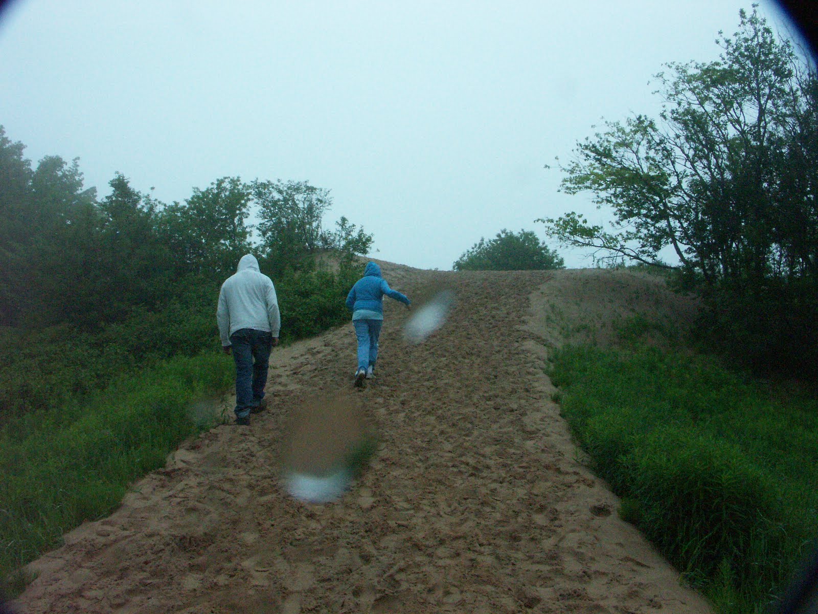
Mike and Alyssa charging up the Log Slide in the wet sand.

 We were poking around at the top and I found some prints...I didn't have my cheat sheet for animal tracks (nor a ruler) but this one was bigger than a 4x6 photo, but not as big as my journal. Its hard to see in the photo, it was easier to see the detail in person, perhaps possibly a rear black bear print...I spotted a ranger and inquired of the nature of the print and he seemed to agree.
 Several yards away, I spotted this track. Dogs are not allowed here and the tracks led off into the woods. Perhaps a coyote??
Here we are looking down the
 other side of the Log Slide where the timber would have been rolled down to Lake Superior. We really wanted to go down and check that out, however there were several signs warning against such action. Apparently, walking UP such a sand dune is nearly  impossible and many rescues/injuries/heart attacks happen here somewhat regularly.  We really didn't want vacation to end on the second day so we decided against
 that one!

A few days later by Whitefish Point we saw one of the carts that were used to pull the logs to the log slides!


On the 1/2 mile trek back to the car I stumbled on this felled tree and was quite amused at the shape of its trunk! I'm not sure what kind it was, but interesting just the same!